

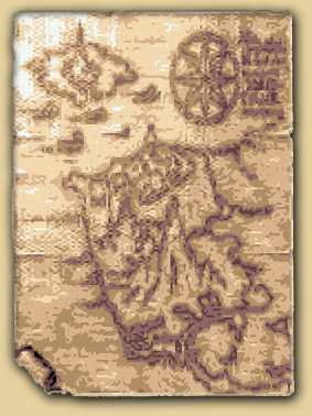
Here you'll find several maps from the Xak series including the entire world map of Xak, the human world, and in-game maps of the various places that Latok visits during his quests. The completed world map is an edited map derived from the Xak III in-game world map and other image/location sources from the Xak series.
Xak Atlas Index:
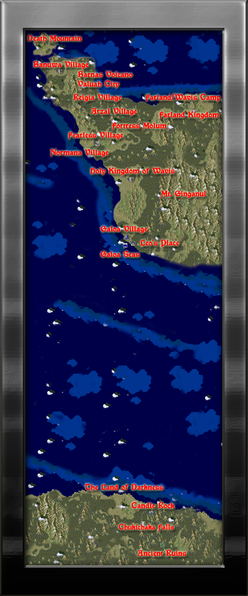
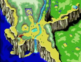
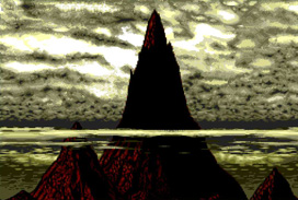
| In this world map, The Land of Darkness to the South refers to a continent in Xak III that not many travelers have set foot upon. Although the land sounds like an evil place and for all intended purposes is where most of the demons have gathered during the course of the events of Xak III, it is not inherently an evil place. In a way the type of terrain surroundings, characters and climate mimic that of the continent of Africa of our own Earth, which is sometimes referrenced as "The Dark Continent". This consequently is also another possible translation or meaning of the original Japanese name of this location. This could also mean that the mainland where the Holy Kingdom of Wavis is situated could be similar to that of Europe. This type of World Map setting is very similar to that of the world map of Ys, in which the land formations and location names are extremely close to our own Earth's locations. This could be seen as another example of similarity between the two series. |
II. Xak: The Art of Visual Stage Maps
(Xak I map content developed by Sonic_aka_T of MSX.org)
Click on image to view larger map size
The Town of Fearless |
Fearless Gate |
Wavis Field 1 |
Pass |


Wavis Field 2 |
Forest |
Forest Riverbank |
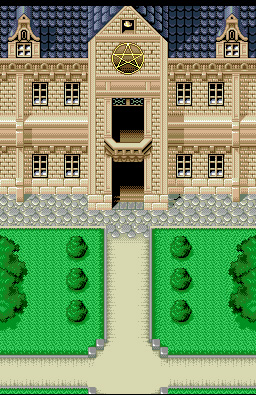
Fray's House |


The Great Tree |
Molum Overpass |
Molum Fortress |
Wavis Field 3 |


Waterfall |
Normana Marsh 1 |
Normana Marsh 2 |
Normana Village |


Normana Overlook |
Gondola |
Normana Underground Passageway Entrance/ Pirate's Hold |
Fearless Church |


Fortress Molum Floor 1 |
Fortress Molum Floor 2 |
|
Fortress Molum Basement |


Water Pressure Room |
Underground Passage 1 |
Underground Passage 2 |
Underground Passage 3 |


Path to Nemnu |
The Hobbit Village of Nemnu |
Tower of Zeglard Entrance |
Wavis World Map |


Currently Under Construction
IV. Other Xak Series Location/Image Sources
Bird's eye-view map pictures of the world of Xak.
| From here you can see most of the places in Xak I while the rest of the mainland continent is covered in clouds to prevent the viewer from seeing just how big the world of Xak really is. |
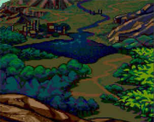
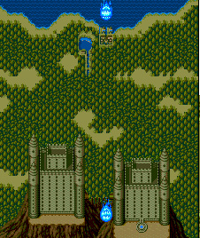
| A closer view of the surrounding areas of Xak I shows a bit more detail as we can now see Fearless village to the North, the forest where the Great Tree resides just East across the river, the rocky mountain path leading directly East to the Fortress of Molum. The posionous marsh and Normana village to the South-West direction as well as the gondola leading down to the underground passageway. You can even see the little stretch of land where the drunk pirate was when finding the first exit out of the underground passageway. |
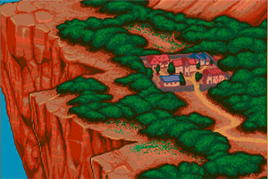
| Yet an even closer bird's eye view image of Fearless village. Here you can see even more detail of the buildings such as the church in the middle and Latok Kart's house in the upper-left hand corner. |
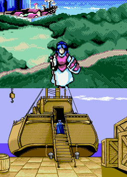
| This image from the opening of the PC-Engine version of Xak I&II shows an area that Pixie is flying to. While I would normally suspect that this is an image of Fearless village since she is directly flying there alone, the surroundings of the village look a lot closer to that of Banuwa village of Xak II. However, comparing the layout of the land in referrence to the first two overhead map images, this image is most likely that of Fearless village. |
| An image of the Holy Kingdom of Wavis from the first Xak game showing that it pretty much borders the Eastern ocean. It sort of borders the ocean in the above Xak III map, but sometimes locations and landmarks/features are not always 100% consistant throughout a series which leads me to believe that a great deal of the following locations below will be based on an educated guess. |

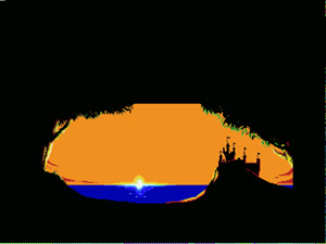
| This image is shown during the opening sequence of Fray CD for the PC-Engine just before the scene showing that the great demon Badu was released from his icy prison in Bazuud. Unfortunately, other than taking a guess that this cliffside with a structure ontop is either Fortress Molum or perhaps even Fearless Village as the surroundings would be similar to that of the third overhead map image of the close-up picture of Fearless village. The fact that this location borders the ocean throws me off a bit. It could even be another shot of the above image of Wavis Kingdom, I'm not sure. |
The following are places visited in the world of Xak that have not yet been located on the main world map.
 |
|

| As Fray travels in the direction of Banuwa village she visits several locations along the way. The first stop lands Fray in Arzal village where the mayor tells her that a blue haired swordsman (Latok) traveled to the Arzas Plain but never returned. Fray travels to the plain where she finds a temple of some kind and eventually ends up in Reigia village which borders a huge lake. From there she travels to the City of Valuah located across the lake on the other side. From there she retrieves the Wings of Divinity from the Barnas Volcano which allows her to fly to the Floating Fortress of Ku Or. Fray along with the help of several other characters defeat the master of Ku Or and the fortress falls into the lake next to the City of Valuah. |
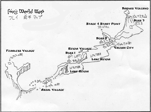
| This image above taken from the Xak II Perfect Note Guide shows the world map of Fray in Magical Adventure. This shows the location of every Arzal village, Reigia village, Lake Reigia, City of Valuah, Barnas Volcano and the cliff where Fray takes flight to the Floating Fortress of Ku Or in relation to Fearless Village of Xak I. |
 |
 |
|
From the City of Valuah, Fray continues her journey and finally reaches Banuwa village situated along the Northern coast (Meaning it would most likely be placed at the top-most of the main continent) and bordering a large forst to the East, the Crystal Valley to the West and Castle Caulyan to the South. Fray reaches the village just in time to see Latok just before he gets aboard a ship headed Northbound across the seas to Death Mountain. .
|
Click on Image for Larger Version |

| An image recently scanned and sent in from the manual of Xak II for the MSX. This image shows an overview of Banuwa village and the surrounding areas which really help explain how close everything is in relation. It is nice to finally see where and how Death Mountain fits into the overall placement of the areas visted during the course of the game. |
 |
| This is an image that I recently took a screenshot of during the ending sequence of Xak II MSX. I had completely forgotten that this existed until I discovered during a second playthrough of the game. Based on this map image and that of the image above, we can gather a very good overview of Banuwa village and the surrounding areas which really help explain how close everything is in relation. What makes this map image great is that I believe it confirms the location of the places visted during Xak II in relation to how it would fit on the main Xak III map! If you take a look at the Xak III world so far... map, you can plainly see that the Northwestern corner of the main continent is not shown. If you were to place this landmass given in this map image over the corresponding area in question, this piece fits in rather nicely. I think that this may definitely lead to a very nice educated guess as to where Xak II's areas lie within Xak III's world map and from this, we can deduce where the areas in Fray In Magical adventure lie and possibly even the Tower of Gazzel. I was very happy to have found this missing piece of this Xak Atlas puzzle! Perhaps I can begin working on the restoration of the Xak III world map once I'm finished with taking the rest of the screenshots from Xak III. |
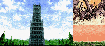
| The following images are of the Tower of Gazzel of which is visted during "Xak: The Tower of Gazzel" and eventually completely destroyed at the end leaving nothing behind but crumbled ruins. Latok and Fray discuss hearing about the location of the tower from a "village mayor". Of which village mayor that is, is uncertain, but more likely that it was Mayor Arina of Banuwa village if Latok's party left for the tower directly following the events of Xak II: Rising of the Redmoon. If there was some time lapse between the two adventures, the it is more likely that they recieved their information from the mayor of Fearless village. All of this is just conjecture for the most part as to where the tower lies, but as it was constructed by Master Engineer Saiten, of whom also constructed most of Castle Caulyan I would imagine that the two locations are not too far from each other. |